Early Islamic Mosques Database
Distribution of excavated structures from the 7th-9th centuries
Project Abstract
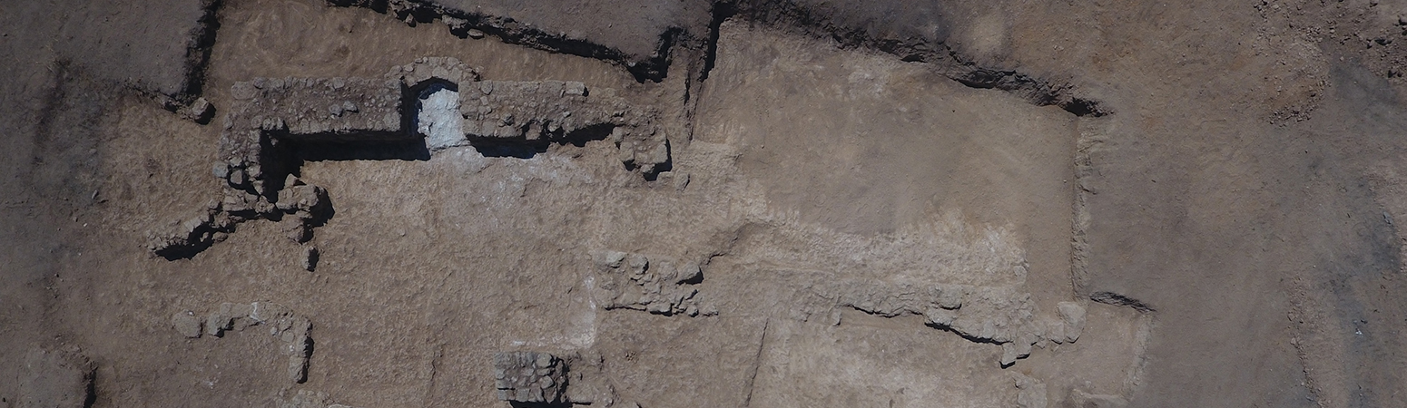
Banner Image credit: "Aerial view of the open mosque at Sederot, Israel" (provided by Dr. Daniel Varga and Federico Kobrin, Israel Antiquities Authority). Photograph by Emil Aladgem, Israel Antiquities Authority. Shared with a CC BY-NC-SA license.
Ancient mosques are one of the features that physically represent the Muslim faith. Dating the mosque on a site or in a region is a significant factor in establishing the earliest verifiable presence of this faith in the area. A correct dating of mosques also contributes to showing the process and the directions of the spread of Islam into different regions in different periods. During the past thirty years, a fair number of structures from early Islam have been exposed in controlled excavations. Well-documented excavations allow for a contextual analysis of the mosque and the site, showing construction phases (including previous floors and walls), earlier structures, and the relation to other architectural elements and remains. Many of the archaeological studies that our database covers thus enable dating the mosque (or some of its construction phases), observing its architectural developments over time, understanding its relation to other activities on the site, and establishing its connection to the region.
The database focuses on excavated mosque sites which have been dated to the first three centuries of Islam, from the 7th century to the 9th or early 10th century. It excludes sites which were never related to an excavation project and only rarely includes unpublished excavated mosques. It presents around 120 structures from Spain, North Africa, East Africa, Greater Syria, the Arabian Peninsula, Iraq, Iran, and Afghanistan. A structure comprising several distinct phases received several entries. The data may comprise the size and form of the mosque, its possible date along with the reason for that dating, the reason for identifying the structure as a mosque (such as having a miḥrāb, the niche orienting the prayer), other structural elements, plans or photos, and references for the excavation reports or other relevant publications. As you shall see, archaeologists sometime suggest dates for mosques based on parallels (i.e. similar examples on other sites) or on the identification of mosques described in texts dating much later. However, four types of archaeological evidence enable an independent dating of early Islamic structures: 1. datable inscriptions on walls or floors, 2. pottery and coins under floors or walls which provide these elements with terminus post quem, that is the date after which construction must have taken place, 3. 14C dates, and 4. pottery, coins, and datable inscriptions from the settlement around the mosque (‘on site’, or ‘from the site’). When such independent dating tools were presented for the mosque, I concluded with my own interpretation for its date.
The database is primarily presented in English with shorter versions in Arabic and Hebrew (see below). For academic purposes, the English version is preferred. You can filter the results in any of the languages, download them, and display their geographical distribution on a map. You may download and use the plans and photos from the database (in English) according to their license unless you are directed to an external link. The building of this database has been made possible thanks to the many archaeologists who generously shared figures with us and to Mohamed ELHamdaoui and Abed al-Razeq Matani who helped with the Arabic translation. Any errors in the data or in the interpretations are my own.
How to find and play with the data?
The best place to start is by clicking 'subjects of observation' (which is located on the right side of the screen). Clicking on it will open a list of continents which have mosques (under ‘context’), 'descriptions' which filter mosques according to some of their characteristics, a map with all our mosques, and the list of mosques (under 'item records', above the map). Another way to retrieve data from the first page would be through 'search within project' for specific names or terms. At the moment, search for site names can only be done in their right transliteration (qaṣr and not qasr). You may get information and figures about each mosque by clicking on its link. The data can also be downloaded to Data Table (CSV) or GIS (GeoJSON) for each of the languages. Finally, you may also play with the map: change it to other map types (click on the layers button on the right corner) and change the distribution mode to circles and small/big squares (on the left).
Examples for selected data according to specific categories: square mosques or mosques in Jordan.
- Download a spreadsheet (csv) of the dataset in English
- Download a spreadsheet (csv) of the dataset in Arabic
- Download a spreadsheet (csv) of the dataset in Hebrew
Author Information:
Hagit Nol, Université libre de Bruxelles
Support:
This project has received funding from the European Union’s Horizon 2020 research and innovation programme under the Marie Skłodowska-Curie grant agreement No 801505.
Arabic Version
قاعدة بيانات مساجد من الفترة الإسلامية المبكرة: توزيع الهياكل المحفورة من القرن السابع الى التاسع
تُعتبر المساجد القديمة واحدة من البقايا المادية للعقيدة الإسلامية. ويُعد تأريخها عاملا مهما في التحقق من بداية تواجد للإسلام في موقع أو منطقة ما. كما يساهم التأريخ الصحيح للمساجد أيضًا في تحديد عملية واتجاهات انتشار الإسلام في مناطق مختلفة وفي فترات مختلفة. في السنوات الثلاثين الماضية، تم الكشف في حفريات أثرية عن عدد لابأس به من بنايات تعود للبدايات المبكرة للاسلام. وتسمح الحفريات الغنية من حيث الوثائق بتحليل نسقي للمسجد والموقع يبين مراحل البناء (بما في ذلك، على سبيل المثال، الجدران والأرضيات المبكرة)، وما سبقها من هياكل، وعلاقتها بما بقي منها من آثار وعناصر معمارية أخرى. كما تساعد العديد من الدراسات الأثرية التي تقدمها قاعدة البيانات في تحديد تاريخ المسجد أو جزء من مراحل تشييده، تطوره المعماري عبر الزمن، فهم علاقته بما جاوره من أنشطة إخرى في الموقع وتحديد ارتباطه بالمنطقة ككل.
تركز قاعدة البيانات على مواقع المساجد التي تم التنقيب في مواقعها الأثرية والتي يرجع تاريخها إلى القرون الثلاثة الأولى للإسلام من القرن السابع الى التاسع او أوائل القرن العاشر الميلادي. تستثني قاعدة البيانات المواقع التي لم يشملها مشروع تنقيب كما انها نادراً ما تتضمن المساجد التي لم يتم نشر نتائج التنقيب فيها. تُظهر قاعدة البيانات حوالي مائة وعشرين مبنى من إسبانيا وشمال إفريقيا وشرق إفريقيا وسوريا وشبه الجزيرة العربية والعراق وإيران وأفغانستان. تم فتح عدد من السجلات بالنسبة للمساجد التي تحتوي على مراحل متميزة. ومما قد تشمل عليه قاعدة البيانات: حجم وشكل المسجد، تاريخه المحتمل مع دوافع ذلك التأريخ، وجود معطيات تساعد على تحديد طبيعة المبنى كالمحراب على سبيل المثال، مخططات أو صور، ومراجع لتقارير عمليات التنقيب أو غيرها من المنشورات ذات الصلة. كما هو ملاحظ، يقوم علماء الآثار أحيانًا باقتراح تاريخ للمساجد على أساس "متماثل" لمواقع أخرى مماثلة أو بالاعتماد على وصف مذكور في مصدر تاريخي كُتب بعد عدة قرون. ومع ذلك، هناك أربعة أنواع من الأدلة الأثرية تسمح بالتأريخ المستقل للمباني الإسلامية القديمة: ا) نقوش يمكن تاريخها على الجدران أو الأرضيات. ب) لقى فخارية او نقود تحت الأرضية أو الجدران تمنح أقرب تاريخ ممكن ("التأريخ الذي يلي")مما يعني أن البناء لا يمكن أن يكون إلا بعد ذلك التاريخ. ج) الكربون المشع. د)يمكن تأريخ اللقى الفخارية أو النقود أو النقوش من المنطقة السكنية القريبة من المسجد ("في الموقع" أو "من الموقع"). عندما أنتهي من تقديم أدوات تأريخ المسجد المستقلة هذه، أختتم بتقديم تفسيري الشخصي لهذا التأريخ.
تم تقديم قاعدة البيانات أساسا باللغة الإنجليزية وتتضمن نسخًا أقصر باللغتين العربية والعبرية. للأغراض الأكاديمية -يوصى باستخدام النسخة الإنجليزية. يمكنك تصفية النتائج بأي لغة من اللغات وتنزيلها والحصول على توزيعها الجغرافي على الخريطة. يمكن تنزيل الصور والتصاميم من قاعدة البيانات (باللغة الإنجليزية فقط) واستخدامها وفقًا لشروط الاستخدام ("الترخيص")إلا في الحالات التي تتم فيها إحالتك إلى رابط خارجي. أصبحت قاعدة البيانات ممكنة بفضل العديد من علماء الآثار الذين شاركونا بسخاء رسومهم التوضيحية وكذلك بفضل محمد الحمداوي وعبد الرازقمتاني اللذين ساعدا في الترجمة إلى العربية. أي خطأ في البيانات أو التفسير هو خطأي أنا وحدي.
كيفية البحث عن البيانات
أفضل مكان للبدء هو الضغط على subjects of observation (موجودة على الجانب الأيمن). ستٌفتح: قائمة قارات بها مساجد (تحت context، سياق)، ثم description (وصف) التي تفرز المساجد وفقا لبعض خصائصها، وخريطة عليها كل المساجد التي تضمها قاعدة البيانات، ثم قائمة المساجد (تحت item records، فوق الخريطة). هناك طريقة أخرى لاستخراج البيانات في الصفحة الأولى وهي: search within project للبحث عن أسماء أو مصطلحات معينة. يمكن الحصول على معلومات وبيانات حول كل مسجد عبر الرابط الخاص به. يمكن أيضا تنزيل البيانات إلى CSV أو GIS/GeoJSON لكل لغة على حدة. في الاخير، يمكن أيضا تغيير الخريطة من نوع لآخر حسب الرغبة وذلك بالضغط على زر الطبقات في الزاوية اليمنى وكذلك تغيير أسلوب التوزيع إلى دوائر ومربعات صغيرة أو كبيرة (على اليسار).
أمثلة لبيانات مختارة حسب تصنيف معين (باللغة الإنجليزية): مساجد مربعة أو مساجد في الأردن.
للتحميل البيانات بالعربية: Download a spreadsheet (csv) of the dataset in Arabic
الدعم
تلقى المشروع دعمًا من برنامج الاتحاد الأوروبي "الأفق 2020" للبحث والابتكار كجزء من منحة ماري سكلدوفسكة-كوري رقم 801505.
المؤلف
حاجيت نول، جامعة بروكسل الحرة الترجمة إلى العربية: محمد الحمداوي.
Hebrew Version
מאגר מידע של מסגדים אסלאמיים קדומים: תפוצה של מבנים חפורים מן המאות השביעית-תשיעית
מסגדים קדומים הנם אחד מהשרידים הפיזיים שמייצגים את האמונה המוסלמית. כאשר אנו מעוניינים לסקור את הנוכחות המאומתת המוקדמת ביותר של האסלאם באתר או באזור, עלינו לתת את הדעת לתאריך המסגד. תיארוך נכון של מסגדים אף תורם לזיהוי תהליך וכיווני התפוצה של האסלאם באזורים שונים בתקופות שונות. בשלושים השנים האחרונות, מספר לא מבוטל של מבנים מתקופת האסלאם הקדום נחשפו במסגרת חפירות ארכיאולוגיות. חפירות המתועדות כראוי מאפשרות פרשנות של המסגד בתוך ההקשר שלו; הן עשויות להציג שלבי בניה (כולל, למשל, קירות ורצפות מוקדמים), מבנים קדומים יותר, וקשר של המבנה עם רכיבים אדריכליים או עם שרידים אחרים. רבים מהמחקרים הארכיאולוגיים שמאגר המידע מציג אמנם מסייעים בתיארוך המסגד (או חלק משלבי הבניה שלו), בסקירת ההתפתחות האדריכלית שלו לאורך זמן, בזיהוי הקשר בין המסגד ובין פעילויות אחרות בתוך האתר, ובהבנת הקשר שלו לאזור.
מאגר המידע מתמקד במסגדים שאתריהם נחפרו ארכיאולוגית ואשר תוארכו לשלוש מאות השנים הראשונות של האסלאם, מן המאה השביעית עד המאה התשיעית או תחילת העשירית. המאגר אינו כולל אתרים אשר לא היו קשורים מעולם בפרויקט חפירה ורק לעיתים נדירות כולל מסגדים שתוצאות החפירה שלהם לא פורסמו. במאגר מוצגים כ-120 מבנים מספרד, צפון אפריקה, מזרח אפריקה, סוריה רבתי, חצי האי ערב, עיראק, איראן, ואפגניסטן. למסגדים, שתוארכו באופן מובהק למספר תקופות, נפתחו מספר רשומות. המידע עשוי לכלול את גודל ומבנה המסגד, תיארוכו האפשרי והבסיס לתאריך זה, הסיבה לזיהוי המבנה כמסגד (למשל, קיומו של מחראב, נישה לכיוון התפילה), תכניות או תמונות, והפניות לדוחות החפירה או לפרסומים רלוונטיים אחרים. כפי שניתן לראות, ארכיאולוגים מציעים לפעמים תאריך למסגדים על בסיס 'מקבילות' (כלומר, דוגמאות דומות מאתרים אחרים), או על פי זיהוי המבנה עם מסגד שתואר במקור היסטורי מאות שנים מאוחר יותר. ואולם, ארבעה סוגים של עדות ארכיאולוגית מאפשרים תיארוך עצמאי של מבנים אסלאמיים-קדומים: 1) כתובות ניתנות-לתיארוך על קירות או רצפות; 2) ממצא קרמי או מטבעות תחת רצפות או קירות – ממצא שמעניק לרכיבים אלו 'תאריך שאחרי' (terminus post quem), כלומר שרק לאחריו יכולים היו להיבנות; 3) פחמן 14; 4) ממצא קרמי, מטבעות, או כתובות ניתנות-לתיארוך מהישוב הסמוך למסגד ('באתר' או 'מהאתר'). כאשר כלי תיארוך עצמאיים כאלו הוצגו למסגד, רשמתי את הפרשנות המסכמת שלי לתיארוך שלו.
מאגר המידע מוצג ראשית באנגלית וכולל גרסאות קצרות יותר בעברית וערבית. למטרות אקדמיות מומלץ לעשות שימוש בגרסה האנגלית. באפשרותך לסנן את התוצאות בכל אחת מהשפות, להוריד אותן, ולקבל את תפוצתן המרחבית על מפה. ניתן להוריד תמונות ותכניות מהמאגר (באנגלית בלבד) ולהשתמש בהן בהתאם לתנאי השימוש ('רישיון') מלבד במקרים בהם הופנית לקישור חיצוני. מאגר המידע התאפשר בזכות הארכיאולוגים הרבים ששיתפו בנדיבות איורים וכן תודות למוחמד אלחמדאווי ועבד אל-רזק מתאני שעזרו בתרגום לערבית. כל טעות בפרטים או בפרשנות הן שלי בלבד.
איך להשתמש במאגר המידע?
בכדי להתחיל, מומלץ ללחוץ על הקישור subjects of observation (הממוקם בצד הימני של המסך). לחיצה על קישור זה תפתח: רשימת יבשות שבהן נמצאים מסגדים אלו (תחת context, קרי, 'הקשר'); רשימת מאפיינים על פיהם ניתן למיין את המסגדים (תחת descriptions, 'תיאורים'), מפה עליה ממוקמים כל המסגדים שבמאגר, או את רשימת המסגדים (תחת item records שממוקם מעל המפה). דרך נוספת להגיע למידע בעמוד הראשון הנה באמצעות חיפוש שמות או מונחים (search within project). בכדי לקבל פרטים ואיורים על כל אחד מהמסגדים, יש ללחוץ על הקישור שלו. ניתן להוריד את מאגר המידע כולו לטבלה (CSV) או לGIS (GeoJSON) לכל אחת משפות המאגר. דבר נוסף שניתן לעשות עם המאגר: 'לשחק' עם המפה – להמיר אותה לסגנון תצוגה שונה (על ידי לחיצה על סמל השכבות בפינה הימנית של המפה), או לשנות את אופן הצגת התפוצה לעיגולים או ריבועים קטנים/גדולים (בצד שמאל של המפה).
דוגמאות למיון המידע על פי קטגוריות מסויימות (באנגלית): מסגדים רבועים, או מסגדים בירדן. מסגדים רבועים או מסגדים בירדן
להורדת מאגר המידע בעברית: Download a spreadsheet (csv) of the dataset in Hebrew
תמיכה
פרויקט זה קיבל תמיכה מתכנית המחקר והפיתוח 'אופק 2020' של האיחוד האירופאי במסגרת מלגת מארי סקלודובסקה-קירי מס' 801505.
מחברת
חגית נול, האוניברסיטה החופשית של בריסל
| Descriptive Attribute | Value(s) |
|---|---|
|
Creator
Vocabulary: DCMI Metadata Terms (Dublin Core Terms) |
Hagit Nol
Vocabulary: Early Islamic Mosques Database |
Suggested Citation
Hagit Nol. (2021) "Early Islamic Mosques Database". Released: 2021-11-14. Open Context. <https://opencontext.org/projects/95b1ef01-9ccb-4484-b0f2-540f4dc54672> DOI: https://doi.org/10.6078/M7SB43WC
Editorial Status
●●●○○Copyright License
To the extent to which copyright applies, this content
carries the above license. Follow the link to understand specific permissions
and requirements.
Required Attribution: Citation and reference of URIs (hyperlinks)
